Kategorie:CN Blackfoot/Vegreville Subdivisions v2 (CAN99v2)

Beschreibung des Autors
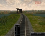
Complete reworked version of Rory Rice’s original CN Blackfoot v1. The route now covers almost 200 miles of the Canadian National’s western secondary mainline (original Canadian Northern Rly) from Denholm, Saskatchewan to Vegreville, Alberta, Canada. Specifically, the end of the Aberdeen Sub (Denholm - North Battleford SK - 15 miles), the entire Blackfoot Sub (N Battleford – Vermilion AB - 124 miles), and the eastern half of the Vegreville Sub (Vermilion – Vegreville AB – 60 miles). The route is single track, dark-territory (non-signaled) with local passing sidings at each small town, and major +6000’ length sidings located at Bresaylor, Waseca, Blackfoot, Innisfree & Vegreville (about every 30 miles). Two main yards are located at the division points of N.Battleford and Vermilion, and a local yard is found at Lloydminster AB. There are two active interchanges; CP Rail at Lloydminster, and the Carleton Trail Rly at N.Battleford.
Major traffic consists of grain, petroleum, chemicals, forestry, pulp and paper, and mixed goods. The main industry along this route is Husky Petroleum, with their Heavy Oil Upgrader & Ethanol plant just east of Lloydminster as well as the downtown refinery. Grain accounts for more traffic but the elevators are scattered over the route, the largest being the Agpro facility near Lavoy AB.
Some segments of the route are quite accurate while others are less so. The route was created as best from memory, maps, photos, Google-Earth, and what MSTS's RE would allow. The purpose of the CN Blackfoot V2 was to update Rory's original work to current MSTS route standards, not to obtain 100% accuracy. Please don't write telling us this grade crossing is in the wrong place, or that siding should be a half mile to the west, etc, etc. This is a very good representation, but not an exact replication.
Signals were originally placed in Blackfoot v1 at a few locations along the route. The real route is non-signalled (it is operated as dark territory with OCS track warrants), so all have been removed. Yes this makes it difficult for activity creators to stage meets with AI trains, but the real route only sees 4 through-freights per day in addition to locals and grain extras, so heavy AI traffic is unrealistic on this line. Activity creators, please see the 'Docs & Maps' folder in this route for detail on the operations, and also a guide to stage AI traffic and meets on non-signalled MSTS routes.
The era of this route is generic mid 1970's to present, however it most accurately represents the 1990's decade. Modern features include such items as the carspawner vehicles, Agricore elevators (a 90's merger of the Alberta & Manitoba Wheat Pools), and 'Internationalized' style crossbucks which Canada adopted in 1985. However the route was 'back-dated' by including more wooden grain elevators and adding stations which had been razed quite some time ago. This was done as interest was expressed at the old mltdownloads forum for the increased switching opportunities and traditional look which wooden elevators give, and to operate Gaetan Belanger's nice RDC Budd cars on this route to recreate the CN's N.Battleford-Edmonton passenger runs. This service was discontinued by CN in 1977 (it never saw VIA service). Stations at Lloydminster, Maidstone, Mannville & Innisfree were added, all long gone, while the stations at N.Battleford, Vermilion, and Vegreville still exist today. N.Battleford station is used by CN and is also the city bus station, while Vermilion station is strickly used by CN crews. Vegreville station is now a visitors centre and cafe, but remains trackside. CP Rail's Lloydminster station still exists and is used by the railway. However, it is sad to report that most of the classic wooden grain elevators are gone off this route as of 2007.
For more lineside facts, operations info, and history, please see the 'Docs & Maps' folder.
Anmerkungen von hwagner
Rory Rice veröffentlichte die CN Blackfoot Sub v1 im Jahre 2003 als ein Meilenstein, was mit dem Trainsimulator möglich war. Dies war für Jahre die erste für MSTS verfügbare Route in Kanada. Die Strecke beginnt in North Battleford und führt bis nach Innisfree.
Die Strecke gibt es zum Download in sieben Teilen unter dem Namen "black1.zip" bis 7 bei trainsim.com. Eine Aufgabe ist dabei. Dazu gibt es noch das Aufgabenpaket "bf1.zip" mit 6 Aufgaben.
2008 wurde die Strecke übrarbeitet und als "CN Blackfoot/Vegreville Subs V2" als Freeware veröffentlicht.
Die Route führt über 200 Meilen von Vegreville bis Blackfoot in Alberta, Kanada. Auf ihr transportieren Güterzüge hauptsächlich Getreide und Öl. Auch Personenbeförderung ist möglich. Die einspurige Strecke hat keine Signale. Zugbegegnungen werden über Funkverkehr (Popup-Meldungen) angekündigt. Zahlreiche Ausweich- und Abstellgleise lassen auch den Rangierfreund auf seine Kosten kommen.
Die drei Installationsdateien "can99v2.zip", "can99Equip.zip", "can99v2Activities.zip" beinhaltenn die Strecke, das Rollmaterial und 14 Aufgaben. Dazu noch XTracks und Newroads und das Fahrvergnügen kann absolut ohne Payware und weitere Downloads losgehen!
Die Dateien sind bei trainsim.com zu finden.
Alle freigegebenen Aufgaben werden hier unter der Kategorie "CN Blackfoot/Vegreville Subdivisions v2 (CAN99v2)" geführt, auch wenn sie für CAN99v1 sind.
--hwagner 18. Juli 2018
Seiten in der Kategorie „CN Blackfoot/Vegreville Subdivisions v2 (CAN99v2)“
Folgende 30 Seiten sind in dieser Kategorie, von 30 insgesamt.